Mont Chaberton: Between Barbed Wire and Safety Rope
With the e-MTB up Mont Chaberton: along former military roads to a crown of concrete — a lesson in composure.
“You’re not actually planning to ride that, are you?”Two hikers press themselves against the rock wall, hands on the safety rope. Their faces say it all: mountain biking? Here? Yes — the crux ahead is barely handlebar-wide, with air on the left and rock on the right. Falling is not an option. And yes — this is exactly where we want to ride.

A few hundred meters later, the rope ends; in its place, three lines of barbed wire flank the trail. The climb feels like a journey back into a war zone. I’ve never served in the military; war, to me, is something from movies, the news, or stories from friends who were stationed in Afghanistan. Up here, just shy of 3,000 meters, the topic feels uncomfortably close.
And yet: peaceful alpine serenity. People climb together toward the summit, lend each other hands on tricky passages, laugh, and embrace at the top. Mont Chaberton shows both — what humans can do to one another, and what they can achieve together.
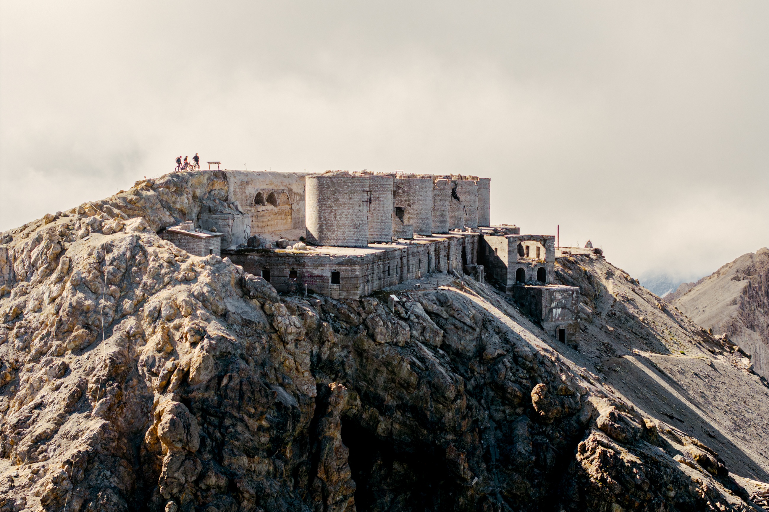
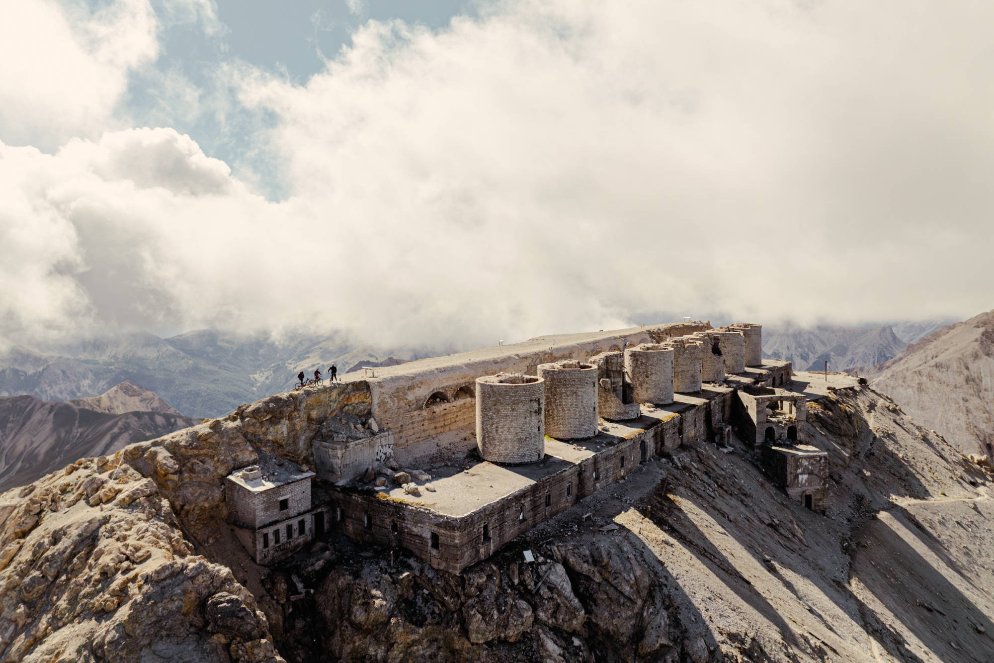
Mont Chaberton, 3,131 m – a mountain as a window into the past
Mont Chaberton stands 3,131 meters tall. Starting in 1898, its summit was blasted flat to carry eight massive gun turrets — at the time, the highest fortress in Europe. On June 21, 1940, French 280-mm mortars destroyed in a few hours what the Italian army had built over years: first the cable car, then the power supply, then six of the eight turrets. On June 24, the mountain fell silent. In 1947, the border shifted — since then, the summit belongs to France. Today, a narrow trail leads across its remains. A tour that tests your legs — and your mind.
Fenils is our start
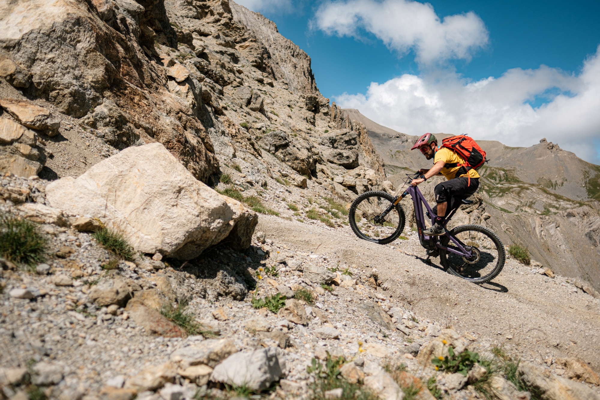
The Genio Militare once carved a 14-kilometer military road with 72 switchbacks far up the slope — closed to vehicles since 1987. What’s left runs like a scar across the mountainside. In many places, the path is no wider than a tire; erosion eats away channels, heavy rain clears debris. Nature is reclaiming what’s hers.

The first third is easy. Then it gets serious. I’m on an e-MTB — and glad for it. The gravel is loose, fallen rocks block the path, and the gradient keeps increasing. We reach the tour’s critical spot. At the “split rock,” the old road has collapsed; a rock spur juts into the air like a dagger, and beside it, a fixed rope serves as a handrail. I roll in, handlebars close to the wall. Walking pace. Eyes fixed on the line, not the rope. Don’t touch the rock. One pedal stroke, a short push — through. Heart pounding, head clear.
Col du Chaberton and the Trail to the Summit
After countless switchbacks we reach the pass, once the turnaround point for motorbikes. From here, it gets truly steep. Gun positions lie in the slope; barbed wire hangs from old posts. Relics of a plan meant to demonstrate invincibility — and that ultimately proved futile.
The trail to the summit climbs over rubble and ancient steps. The wind strips the warmth from under my jacket. Then the summit plate appears: a perfectly flat surface, part concrete, several thousand square meters wide — the size of a football field. Tower stumps stand in the light. I sit on the edge, set the bike down, take a drink. The water tastes metallic. Maybe the bottle. Maybe the place.
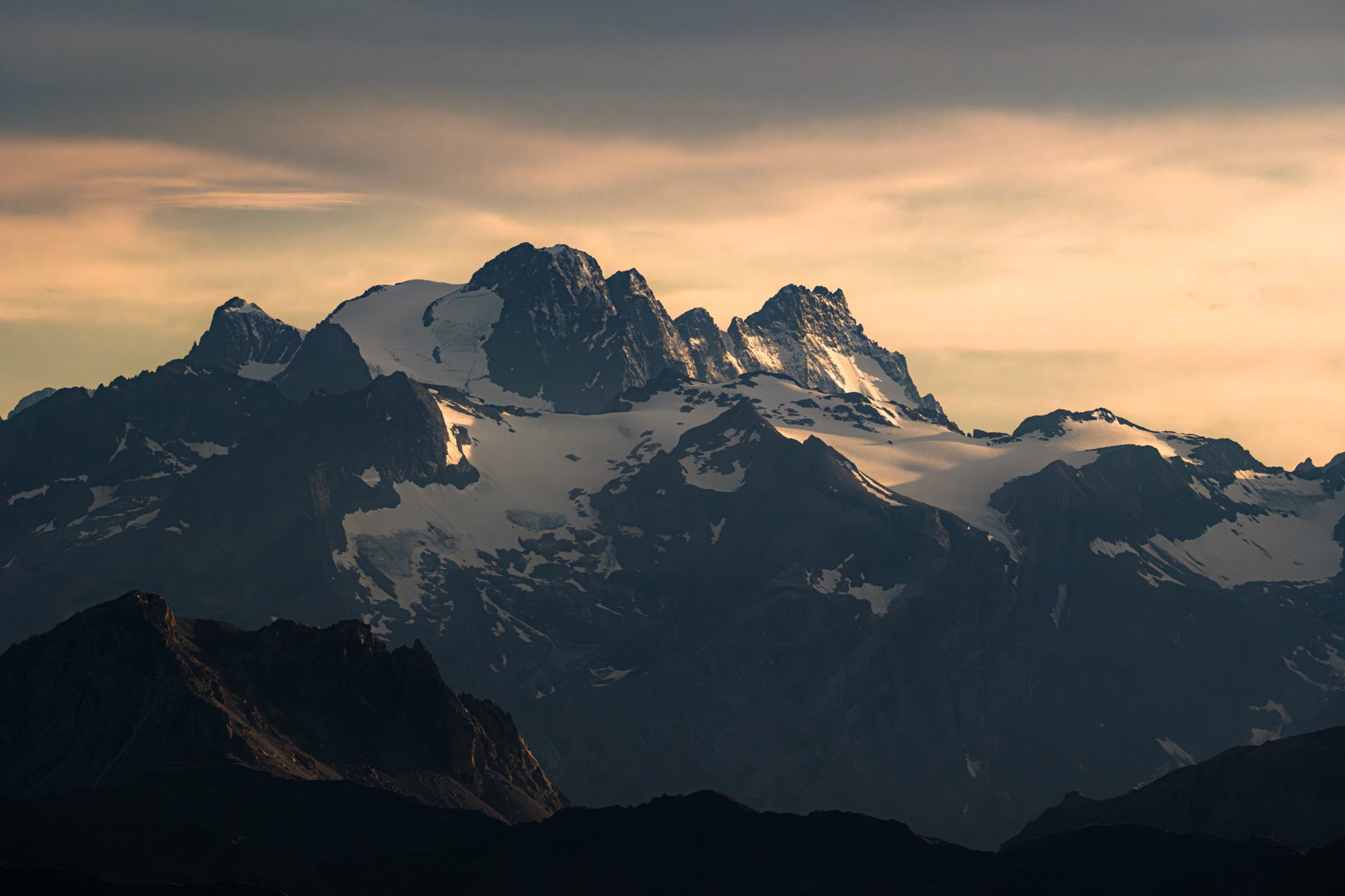
I turn in a slow circle:
- Mont Blanc to the north
- Barre des Écrins and La Meije to the west
- Gran Paradiso to the northeast
- Rocciamelone opposite
- Monviso to the south/southeast
On rare, crystal-clear days, Monte Rosa glints on the horizon. Today, what I see is enough.
Reflections at the Summit of Mont Chaberton
War remains senseless. Killing remains senseless. But being defenseless isn’t the answer either. Mountains teach resilience without aggression: those who have strength can stand firm. For me, that means skill, fitness, and technique — not to attack, but to endure. Si vis pacem, para bellum. I feel the call to train — body, mind, coordination. The enemy within is inertia. Practice is the antidote.
The descent brings me back to the present. From Col du Chaberton, the trail drops toward Montgenèvre: steps, rock gardens, occasional exposure. Two fingers on the brakes, eyes ten meters ahead — full focus. Lower down, the slope changes rhythm: flow. The sun hangs low, the valley drinks in the light. A day that began with barbed wire ends in gold.

The Susa Valley is rich in contrasts. Alpinism takes many forms here: on foot, on the rock, or on the bike. Even 4×4 adventurers get their thrill. The valley feels like a vast playground — and like a window into the past. The mountain flanks are lined with old military posts. A stark contrast between then and now, between the fear of war and the freedom we feel up here. An experience that stays.
Tour Info:
- Start: Fenils (Val di Susa)
- Destination: Mont Chaberton (3,131 m) – leveled summit plateau with tower remains
- Elevation gain: approx. 1,900 m (from Fenils)
- Key sections: “Split Rock” (fixed rope, exposed), steep final section from Col du Chaberton (~400 m to the summit)
- Terrain: loose gravel, scree, decayed military road → sometimes only tire-width
- Season: mid-summer to early autumn; start early (cold / thunderstorms)
- Rules: former military road closed to motor vehicles; observe closure times & local notices
- Gear: warm layers, gloves, 2–3 L water, energy bars, emergency kit, mini toolbox
- Note: Monte Rosa visible only on exceptionally clear days